



TIE Events
Time: 12:30-13:30
Location: Kalorama
Spectrum's Critical Role in Remote Sensing and Geoscience: How do we move beyond regulatory conflicts to innovation as spectrum congestion increases?
Event Code - TIE.01
Event Description: The use of radio frequency spectrum by diverse, emerging technologies (especially wireless telephony and satellite broadband) has grown significantly in the past few decades. As spectrum allocations become more congested, the disputes between divergent users of radio frequency spectrum have become more intense. Regulatory conflicts at the national and international level have grown with the geoscience and remote sensing communities particularly involved and impacted, ranging from disputes about passive microwave observations for numerical weather prediction to allocations for global navigation satellite systems (GNSS). Much has been said by regulators and policymakers about the need for spectrum sharing, but research and innovation around such sharing has been limited. Such innovation also requires considerable coordination and cooperation across sectors and fields - from engineers and scientists to regulators and policymakers. This topic is particularly timely as the world approaches the triennial World Radiocommunication Conference (WRC-27) in Shanghai in October and November 2027 where many agenda items will address spectrum challenges faced by the geoscience and remote sensing communities.
This session will convene a panel of diverse experts in spectrum engineering, geoscience applications and regulatory policy for a spirited moderated discussion of these complex issues. The session will explore the trade offs between spectrum sharing and protection of key remote sensing bands, and the required innovation to make sharing possible, weighing the perspectives of government, academic and private sector participants, while encouraging audience engagement in the dialogue. This topic is particularly important for the geoscience and remote sensing community at this time because the threats of harmful interference to the technologies we rely on is growing. In addition, new developments in remote sensing for geoscience related applications will potentially need more spectrum allocation, not less. IEEE GRSS Frequency Allocations in Remote Sensing (FARS) Technical Committee has increased its engagement in U.S. regulatory processes with multiple filings in the past year, which will be discussed on the panel. Raising awareness of these challenges across the geoscience and remote sensing communities is particularly important as we will need to continue to increase engagement in regulatory process to communicate the value of our uses of radio frequency spectrum.
Organizer/Moderator:
- Renee Leduc, Principal & Founder, Narayan Strategy
Panelists:
- Ambassador Stephan Lang (ret. U.S.), Senior Advisor, Crest Hill Advisors, LLC
- Dr. Lihang Zhou, LEO Satellite Product Manager, U.S. NOAA Satellite and Information Service (NESDIS)
- Dr. Pouyan Amirshahi, Senior RF Spectrum Engineer, Office of Spectrum Management U.S. National Telecommunications and Information Administration
- Dr. Yan Soldo, Frequency Management and Technology Coordination Engineer, European Space Agency
- Beau Backus, Principal Professional Staff and Senior Spectrum Manager at the Johns Hopkins University Applied Physics Lab (APL), and Chair, IEEE GRSS Frequency Allocation in Remote Sensing (FARS) Technical Committee
Time: 11:00-12:15
Location: International Ballroom East
Geospatial Workforce 2030: Industry Demand, Leadership Perspectives, and the Next Generation of Talent
Event Code - TIE.03
Event Description: The geospatial and remote sensing industry is entering a decade of unprecedented transformation driven by advances in Earth observation, artificial intelligence, defense and intelligence modernization, climate resilience initiatives, digital infrastructure, and autonomous systems. While global demand for geospatial intelligence, location analytics, and decision-support services is accelerating, organizations across government, commercial enterprise, and defense sectors are simultaneously facing significant workforce shortages, shifting hiring expectations, and a widening disconnect between academic preparation and employer needs.
This interdisciplinary panel will provide IEEE IGARSS 2026 attendees with a forward-looking assessment of the geospatial market through 2030 while candidly addressing one of the industry's most urgent issues: how to attract, prepare, and retain the next generation of geospatial professionals.
Designed specifically for young professionals, graduate students, academic institutions, and geospatial businesses, the panel will combine executive market intelligence, employer hiring perspectives, leadership insights, and early-career realities to create a practical discussion on where the geospatial sector is growing, what skills will be most in demand, and how organizations can respond to changing workforce dynamics.
The session will open with a visual industry outlook presentation featuring geospatial market forecasts, workforce data, hiring infographics, and trend indicators spanning civil government, agriculture, climate, commercial analytics, and defense/intelligence applications. This will be followed by a moderated panel discussion exploring:
- the current and projected economic outlook of the geospatial industry,
- major business growth sectors for remote sensing and geospatial analytics,
- workforce shortages and the evolving geospatial talent pipeline,
- hiring expectations from defense, intelligence, and commercial employers,
- the disconnect between university curriculum and industry readiness,
- the perspectives of emerging professionals entering the labor market, and
- actionable recommendations for businesses, universities, and professional societies to strengthen geospatial career development.
This session is intended to serve not only as a market briefing, but as a strategic dialogue connecting industry leaders, academia, and young professionals around the future sustainability of the global geospatial workforce.
Organizer/Moderator:
- Dr. Shawana P. Johnson, GISP - CEO, Global Marketing Insights
Industry economist and geospatial market strategist presenting the Geospatial Industry Outlook, workforce infographic, and key trend indicators.
Panelists:
- Dr. Zorana Jelenak - UCAR/CPAESS Project Scientist Federal Civil Government
Senior government contract executive perspective on geospatial leadership, mission needs, and long-term industry evolution. - Grace Braver - Recent M.S. Graduate, Geospatial Analysis
Emerging professional perspective on graduate preparation, employment search realities, and next-generation workforce expectations. - Tim Leary - Defense & Intelligence Lead, NV5
Employer perspective on defense/intelligence hiring demand, technical competency gaps, and future recruiting needs.

Dr. Zorana Jelenak
Dr. Zorana Jelenak is a Project Scientist with UCAR/CPAESS supporting the NOAA Ocean Surface Winds Team, where she has spent more than 25 years advancing satellite and airborne remote sensing for operational environmental applications. She leads the development, calibration, validation, and transition of Earth observation data into trusted products used by weather forecasters, emergency managers, and decision-makers worldwide. Her work spans multiple satellite missions and hurricane reconnaissance campaigns, providing a unique perspective on the evolving geospatial workforce, operational innovation, and the growing partnership between government and the commercial remote sensing sector.

Grace Braver
Grace Braver is a recent May of 2026 M.S. graduate in Geospatial Analysis from East Tennessee State University. Her graduate research focused on applying machine learning and remote sensing to model post-Hurricane Helene landslide susceptibility in East Tennessee, combining AI, GIS, and environmental data to support geohazard assessment. Prior to joining Esri as a Solutions Engineer Intern, Grace gained experience in both the public and private sectors, supporting Structure-from-Motion photogrammetry and geohazard assessment with the National Park Service's Geologic Resources Division and aerial mapping and LiDAR production at Kucera International.
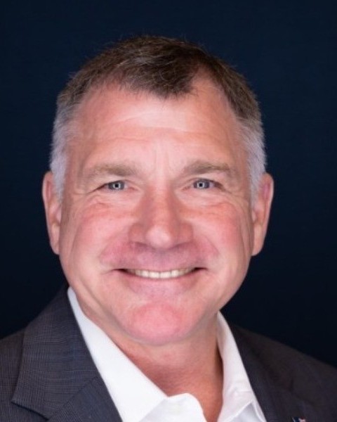
Tim Leary
As the Defense and Intelligence Lead at NV5 Mr. Leary is a dedicated, diligent Geospatial professional with 30+ years' experience in cutting-edge remote sensing; advanced imagery processing; geographic information systems; business development; business and program management; marketing; and technology integration. He has extensive experience in International Business Development, Operations, and Project Management and has worked for the last 15+ years developing an extensive international portfolio of partners, clients, and SMEs. Among many other projects he has supported imagery and LiDAR mapping projects in North America, South America, Africa, Australia, and New Zealand.
Time: 15:00-16:15
Location: International Ballroom East
Quantum Technology for Remote Sensing
Event Code - TIE.04
Event Description: Quantum Sensing is an emerging sensing modality that uses quantum properties of matter and light---namely, quantum superposition, measurement, and entanglement---to achieve unprecedented measurement sensitivity and performance, including quantum-enhanced methodologies that outperform their classical counterparts. Typical quantum sensors exploit techniques such as quantized energy levels in atomic systems, mater waves, quantum entanglement, superposition of quantum states, quantum illumination methods, and manipulation of photons and atoms, in general. Guided by advancements in our ability to generate, manipulate, and control quantum systems, the emerging quantum sensing technologies promise unrivalled sensitivity, resolution, and precision, potentially leading to game-changing applications. Significant gains include technologies important for a range of NASA, Department of Defense, National Reconnaissance Organization, and United States Space Force missions such as timing, remote sensing, in situ measurements, metrology, interferometry, quantum communication, ranging, imaging, radar and lidar receivers, and gravity measurements.
This Technology, Industry and Education (TIE) session will bring together a panel of experts from industry, academia, and government, to brainstorm with the IGARSS attendees on the potential of Quantum Sensing in the near and far terms. After some brief remarks by the panel members, questions from the moderator, the audience will engage with the panel members in an open question and answer session to explore the current state of the art in quantum sensing and the potential for revolutionary gains in the performance of various sensor types.
Organizer/Moderator: Dr. Upendra N. Singh, NASA Technical Fellow for Sensors and Instrumentation, NASA Langley Research Center, USA
Panelists:
- Dr. Lute Maleki, President and CEO OE Waves, USA
- Dr. Dana Anderson, Founder & Chief Science Officer, Infleqtion, USA
- Dr. Robert Williamson, Vice President, Monarch Quantum, USA
- Dr. Sristy Agrawal, Co-Founder & CEO, Mesa Quantum Systems, USA
- Dr. Sheng-Wey Chiow, NASA Jet Propulsion Laboratory, USA
- Dr. Bogdan Neculaes, Portfolio Manager for Disruptive Computing, Networks and Sensors, Boeing, USA
Time: 09:45-11:00
Location: International Ballroom East
How good is your camera, actually? - Understanding camera performance with the new IEEE 4001 standard
Event Code - TIE.05
Event Type: Industry Workshop
Event Description: There are many aspects of performance for a camera. To state this another way, there are many ways in which a camera can be a limitation, or cause disappointment, in a given application. Very often, camera specifications do not contain all the information needed to predict application performance. Recognizing this situation, the hyperspectral imaging community has worked to develop the IEEE 4001 standard, which defines a set of camera characteristics that give an essentially complete description of the performance of a hyperspectral camera. With some adaptation, this standard is also applicable for quantifying the performance of other types of cameras, including color, multispectral, snapshot and thermal cameras, for which a similar resource has been missing. The IEEE 4001 shares a common core with the EMVA-1288 standard but expands on the solid physics of this document. The new standard also defines camera-related metadata describing the influence of camera properties on a given image.
The course will first review the signal chain through any camera, from incoming light to digital data. The main part of the course covers the many aspects of camera performance, including nominal characteristics as well as non-ideal situations and defects. The course takes the IEEE 4001 standard for hyperspectral imaging as a basis, but also covers conventional, multispectral, and thermal cameras. Topics covered include measures of resolution, light collection, noise, and saturation. Bandwidth and spectral sampling of hyperspectral cameras is discussed, as well as the spectral response of conventional cameras. Many types of imperfections are covered, including distortion, fill factor effects, nonlinearity, dead pixels, stray light, and polarization dependence, as well as spectral, spatial, and temporal co-registration in spectral imaging. It is shown how image metadata corresponding to many of these characteristics can quantify camera-related noise and imperfections in imagery, potentially informing and enhancing image processing. The course will also provide a brief overview of hyperspectral applications and market sizing.
Organizer/Moderator: Chris Durell, Development Director, Remote Sensing, Labsphere.
Panelists:
- Chris Durell, Development Director, Remote Sensing, Labsphere
- Dr. Torbjorn Skauli, Professor of Optical Sensors at the University of Oslo
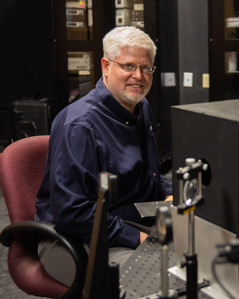
Chris Durell
Chris has worked for Labsphere, Inc for over 30 years in many executive capacities. He is currently leading worldwide business development in remote sensing technology markets and products. Chris helped to found and develop the IEEE 4001 Hyperspectral Standard and participates in several other optical standards efforts.
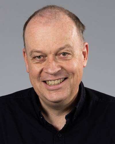
Dr. Torbjorn Skauli
Dr. Torbjorn Skauli is professor of optical sensors at the University of Oslo. Skauli is involved in numerous research projects related to cameras and imaging from satellites and other platforms. He has served as vice chair and lead author for the development of the IEEE 4001 standard for hyperspectral imaging.
Time: 11:00-12:15
Location: International Ballroom East
Operational Hyperspectral Imaging from Space: Translating Science into Actionable Intelligence
Event Code - TIE.06
Event Description: Spaceborne hyperspectral imaging (HSI) is transitioning from a series of research-driven missions to a broader and more operational Earth observation capability. With major international efforts such as the Explorer for Artemis, Geology, Lunar, and Earth (EAGLE), Copernicus Hyperspectral Imaging Mission for the Environment (CHIME), EnMAP, PRISMA, and EMIT, alongside a rapidly expanding commercial sector, the hyperspectral ecosystem is entering a new phase of growth.
This panel brings together experts from government space agencies, international programs, and industry to examine the current state and future trajectory of hyperspectral imaging from space. Discussions will address the hyperspectral paradigm shift across many critical pillars: temporal coverage, mission evolution, sensor philosophies, the data paradox, trust at scale, and fidelity challenges. Particular attention will be given to the risk of "spectral silos," data that is fast and inexpensive but lacks the traceability and radiometric fidelity required for long-term applications such as climate monitoring and defense. The conversation will also touch upon lower-level topics such as sensor design, calibration and validation efforts, and trade-offs between spectral, spatial, and temporal resolution.
Organizer/Moderator: Emmett Ientilucci, Gerald W. Harris Professor, Rochester Institute of Technology
Panelists:
- Dr. Rob Green o JPL Microdevices Laboratory Director, AVIRIS, EMIT-PI, VSWIR-Project Scientist
- Dr. Marco Celesti o Mission Scientist for CHIME and FLEX. ESA Earth and Mission Science Division
- Dr. Jens Nieke, Project Manager, ESA
- Mr. Trond Loke, CEO at Norsk Elektro Optikk, HySpex
- Dr. David Paredes, Head of the DeepTech Unit at Kuva Space
- Dr. Keely Roth, Lead Hyperspectral Scientist, Planet Labs
Time: 12:30-13:45
Location: International Ballroom East
Data Quality and Interoperability (JACIE)
Event Code - TIE.07
Event Description: As Earth observation commercial data providers continue to improve their calibration techniques (pre-launch, on-board, and on orbit) and as their data quality assessment tools and techniques improve year over year, there are benefits to be gained through Civil and Commercial missions developing interoperability tools which are deeply rooted in the topic of data quality. This IGARSS TIE session will explore how the nation can prepare for the impact of future enhanced satellite missions with unprecedented technical and imaging capabilities including expanded spectral channels, higher temporal revisit, and higher spatial resolution while integrating into interoperable data streams for adoption into end user and scientific workflows. This session invites stakeholders from government, academia, and industry to reflect on end user and scientific application readiness and agility in the face of rapid technological change, and to identify pathways for sustainable Civil and Commercial mission growth in Earth observation dataset interoperability.
After presentations from Government and Commercial organizations; a moderator will lead a panel discussion through topics related to data quality, data interoperability, data trust, and much more. Join us for an engaging and informative session that forges a path forward for the future of Earth observation Civil and Commercial mission data quality and interoperability and the exciting advancements that will enable cutting edge science and end user applications.
Organizer/Moderator: Cody Anderson; USGS EROS Cal/Val Center of Excellence (ECCOE) Project, Project Manager
Panelists:
- Tim Newman; USGS National Land Imaging (NLI) Program, Program Coordinator
- Doug Daniels; USGS National Land Imaging (NLI) Program, Principal Engineer (Aerospace)
- Melissa Martin; NASA Commercial Satellite Data Acquisition (CSDA) Program, Program Manager
- Dana Ostrenga; NASA Commercial Satellite Data Acquisition (CSDA) Program, Project Manager
- Joshua Sisskind; Vantor; Principal Product Manager
- Drew Bower; Vantor; Sr Business Solutions Engineering Director
- Jeff O'Neil; Planet; Director of Government Affairs
- Katie Salvaggio; Planet Federal; Senior Program Manager
Time: 16:15-17:30
Location: International Ballroom East
Government and commercial integration for Earth Intelligence - USGEO/USGIF
Event Code - TIE.08
Event Description: The panel will highlight the benefits and challenges of U.S. government agencies working with commercial Earth Observation data providers, and how commercial EO data is used to meet public needs. The panel will also touch on data licensing terms, and how foundational EO data from the Federal government is used by the commercial sector to provide enhanced products and services
Organizer/Moderator: U.S. Group on Earth Observations (USGEO), with panel moderator Tim Newman, USGS National Land Imaging (NLI) Program, Program Coordinator.
The networking mixer is sponsored by the U.S. Geospatial Intelligence Foundation (USGIF).
Panelists:
- Aravind Ravichandra, TerraWatch Space, Founder and CEO
- Mark Bowman, MITRE, Commercial Space Advisor
- Raleigh Martin, NSF Directorate for Geosciences, Program Director
- Gerard Peltzer, NOAA/NESDIS Commercial Data Program, Project Manager
- Dana Ostrenga, NASA Commercial Satellite Data Acquisition Program, Project Manager
- Ashish Raval, Synoptic, President & CEO
Time: TBA
Location: TBA
TBA
Event Code - TIE.09
Event Description: TBA
Organizer/Moderator: TBA
Panelists: TBA